🎯
Mission
To provide reliable, decision-ready geospatial intelligence that reduces project uncertainty and improves planning quality.
Space to dashboard site intelligence for evidence-based planning, monitoring and management of land, water and infrastructure assets.
BhuSense is an all-in-one geospatial technology consultancy that helps institutions, local bodies, infrastructure teams, CSR programmes and development agencies understand sites through maps, data and dashboards.
Our approach connects remote sensing, GIS, drone survey, field validation, domain knowledge and visual dashboards. Instead of giving only static maps, we deliver an integrated intelligence layer that supports planning, monitoring, compliance and stakeholder communication.
BhuSense workflow: satellite intelligence + GIS analysis + field verification + dashboard delivery.
To provide reliable, decision-ready geospatial intelligence that reduces project uncertainty and improves planning quality.
To become a trusted international-standard geospatial consultancy for land, water and infrastructure solutions.
To integrate satellite, drone, GIS and field data into dashboards, reports and implementation-ready insights.
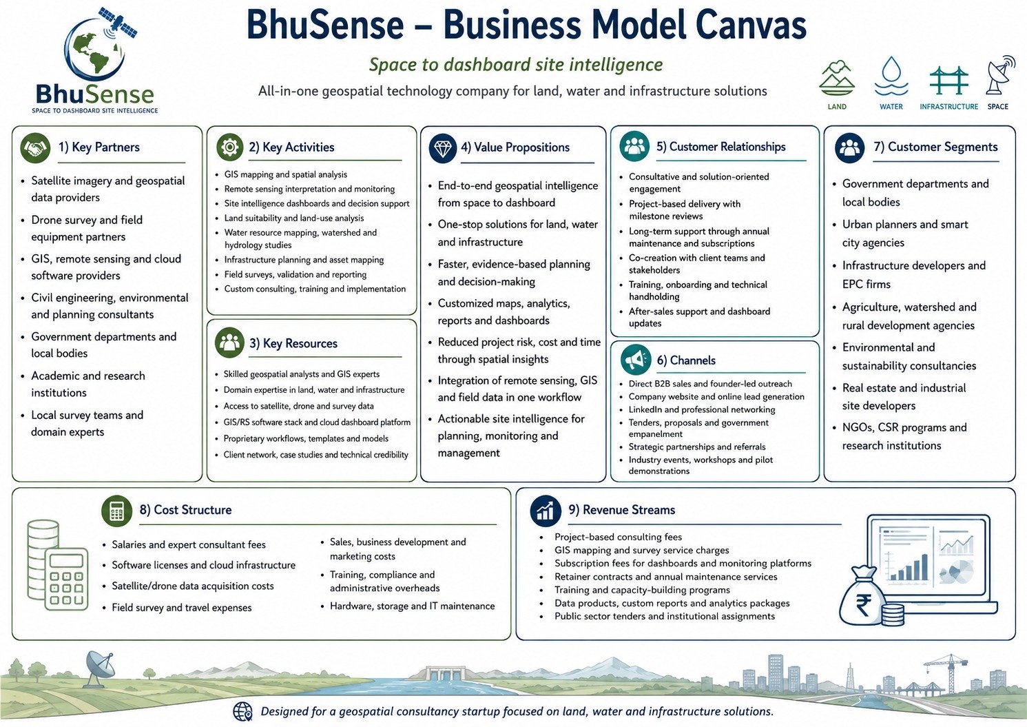
Business model canvas used as strategic reference for the website.