
Client sectors we serve
BhuSense Consultancy
Space to dashboard site intelligence.
All-in-one geospatial technology company for land, water and infrastructure solutions. We convert satellite imagery, drone survey, GIS analytics and field validation into decision-ready maps, reports and dashboards.
✓
End-to-end workflow Data acquisition, analysis, field validation, dashboard and reporting in one project pipeline.
↗
Evidence-based planning Faster, spatially informed decisions for government, infrastructure and sustainability teams.
BhuSense Site Dashboard
LandSuitability
WaterHydrology
InfraAssets
Statistical capability view
Solution verticals
View All Verticals
One geospatial company for land, water, infrastructure and space intelligence.
Business model canvas
Built for consulting delivery, recurring dashboard support and scalable data products.
BhuSense combines partner networks, geospatial experts, satellite/drone data, proprietary workflows and client-facing dashboards to reduce project risk, cost and decision time.
Open Business Model Canvas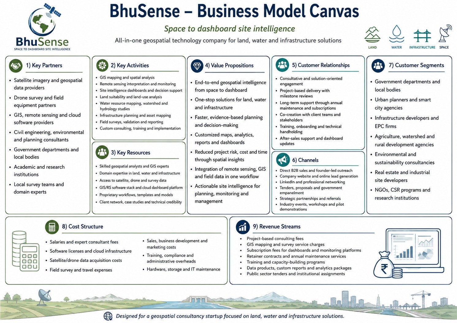
Reference business model canvas included from your provided design.
How we work
From space data to dashboard intelligence in five steps.
1
Collect
Satellite, drone, GIS, client records and field data.
2
Process
Clean, classify, digitise and structure spatial layers.
3
Analyse
Suitability, risk, asset, hydrology and monitoring analytics.
4
Validate
Ground survey, expert review and domain checking.
5
Deliver
Reports, map books and dashboards for action.
Latest insights
All Blogs
Blog cards for thought leadership and lead generation.
Need site intelligence for a project?
Share your land, water, infrastructure or dashboard requirement. BhuSense will convert it into a clear geospatial scope.